The Blue Dick Mine
( yes that is the official USGS name for this mine )
The Blue Dick mine is at 34.41292N 112.47883W at 6382 ft elevation - MinDat info
Detailed GPS tracks, directions and google map info are at the bottom of this page
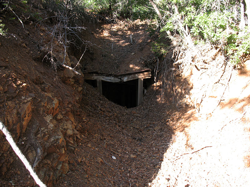
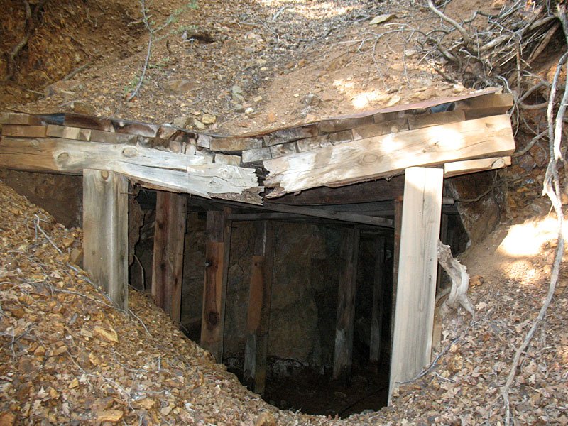
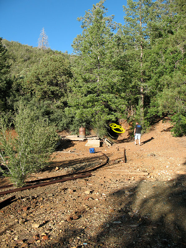
There are at least 3 entrances. The one above being very substantial with left over foundations and some narrow gauge rails leading into it.
The mine has at least 6 levels and lots of shafts. It is partially collapsed but in excellent shape with the wood beams ( made from tree trunks ) being in exceptionally good condition. The mine is dry and very cool.
This mine was part of the mining boom around groom creek in the Bradshaw Mountains in Yavapai county south of Prescott AZ. It showed production from 1902-1928 with a reported $200,000 in gold in 1902 dollars. However there are references from as far back as feb 1890 about this mine. this story is from the 1890's NY times and cites the Blue Dick mine and a flood that was caused by a failure of a dam in the area which killed many miners and washed away whole towns as far away as Mayer Arizona.
The entire area is no longer considered "economically viable" for doing mining by large companies however numerous placer and patented claims are being worked currently and the various rivers and streams yield gold by panning and metal detectors. There is a USBM field study of this area.
The trip up to this mine was flat scary. Like fear-for-your life scary.
Nothing like the fear of DEATH to really create fun.
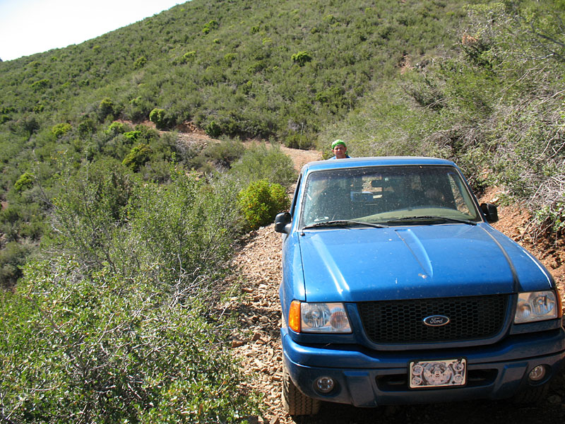
The road ( FR97B and FR667 ) are 100 years old and very precarious with shear drops of 1000ft from the road side and barely enough room for a small 4x4 ranger. Your wheels are always about to fall off the cliff. DO NOT bring a wide 4x4 as you will fall off the road and its a very long way down. There are also very steep slopes, huge rocks, high tilt angles and everything bad you can imagine. The road is much more of a path for a ATV then a truck.
These pics DO NOT really do justice to shear drop. I did not take pics during the most intense parts of this drive.
Notice the wheels. We are against the right hand side of the road and our wheels are barely clinging to the left hand side. You can see the vertical drop behind us on the trail. It drops sharply and according to topo maps is 1200 feet down.
We AVERAGED 6MPH. This part is very level and no huge road problems. Most of this road was WAY more difficult then this.
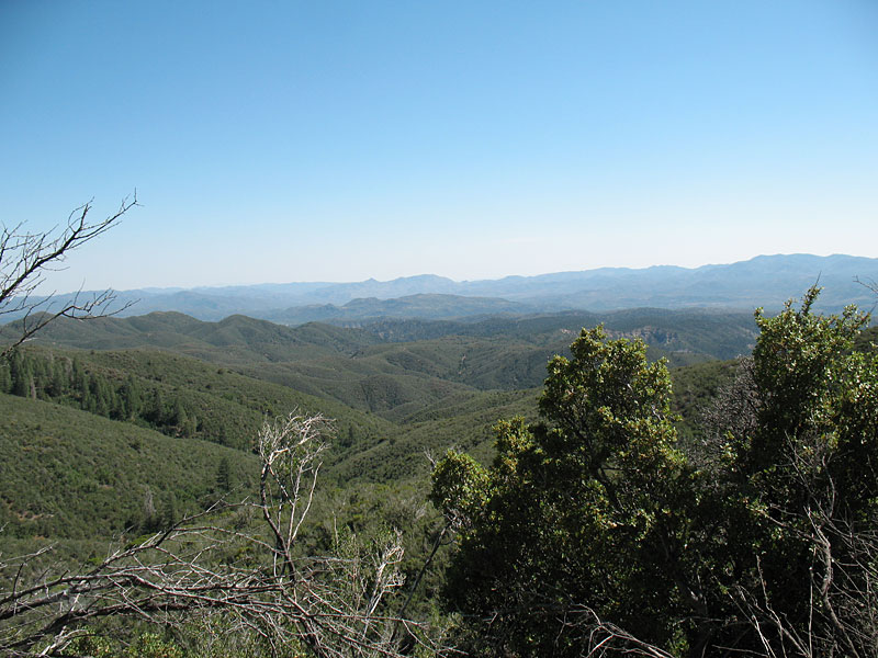
What you don't see in the above pic is the view away from the truck. Its a nice view from 6400 feet. The close up trees are just the very tops of very tall trees that somehow cling to the vertical drops.
In this video we are going seriously up hill and spinning tires and almost falling off the mountain, to the right just past the bushes is a shear drop of at least 1000 ft. There are also huge rocks and the truck is tilted towards falling off. We are also going over big rocks barely visible in the video.
I admit it was great fun
The roads are tiny and almost invisible buried in brush..
The truck was seriously scratched on both sides with deep scratches. Thousands of them. Right down to the metal. You can hear this occurring in this video as we drive thru brush. Greg loved it as it gave the truck a nice well used look
Greg decided to ride in the bed of the truck so he could jump out should we roll off the mountain. I can't imagine going over the bumps and stuff back there, but as long as he didn't spill the beer he was good ! He had a lot of fun back there tho. Here we were driving thru brush and he was thanking the brush for scratching his truck.
After 6 MILES of the 5 MPH road ( 45 minutes of hell ) we eventually arrived at the mine site.
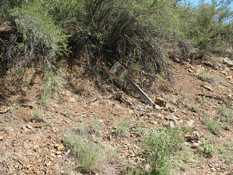
it was carefully hidden, but the tailings, foundations and rails gave it away. the mine is where i colored yellow.
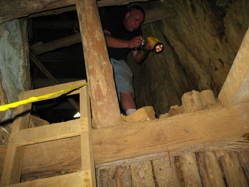
this was a pretty good mine
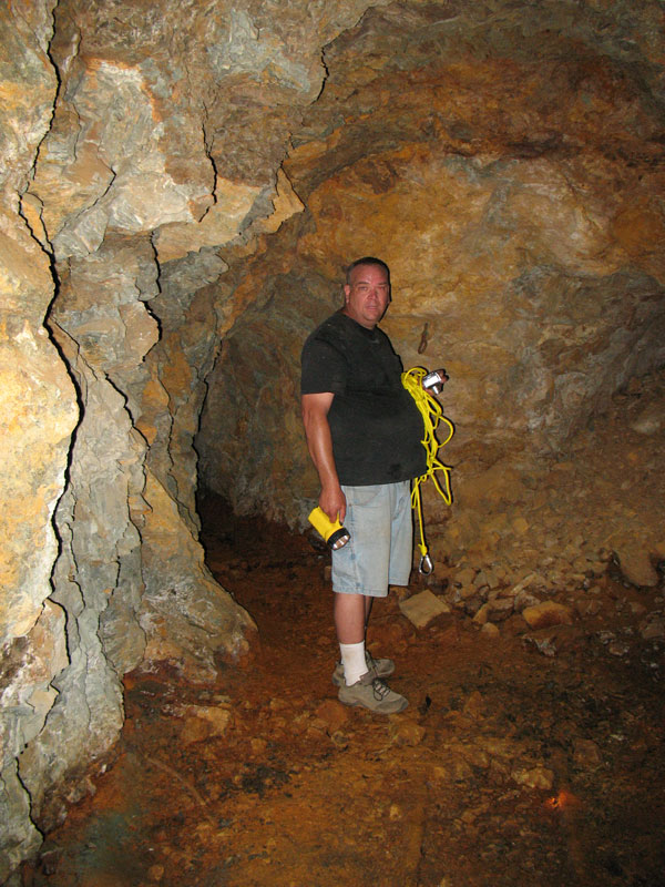
nice structure - no rot - nice and dry mostly
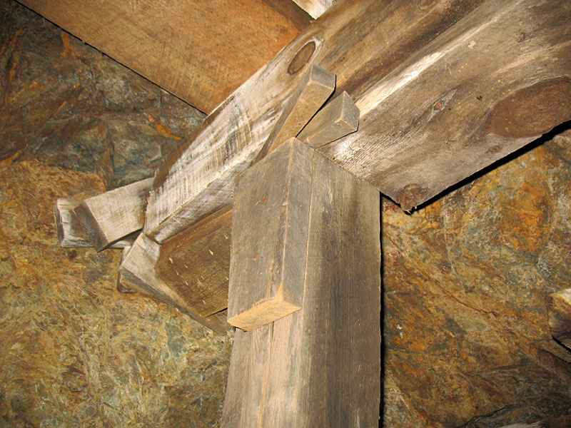
The construction looks like it did not use a single nail. Well ok maybe a few.
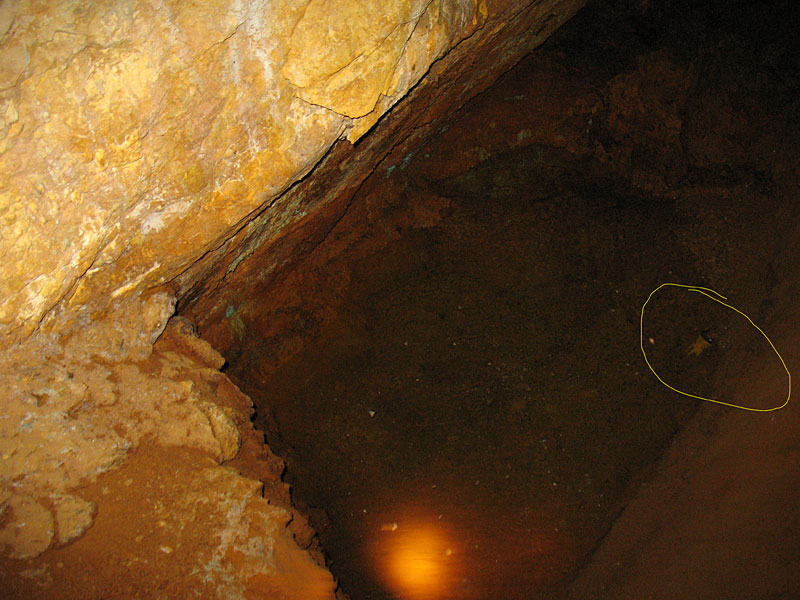
This mine had a side tunnel that had a tiny pond in it. It was covered in spiders on the roof.
The pond has a recent flashlight from previous explorers. Is this your flashlight ?
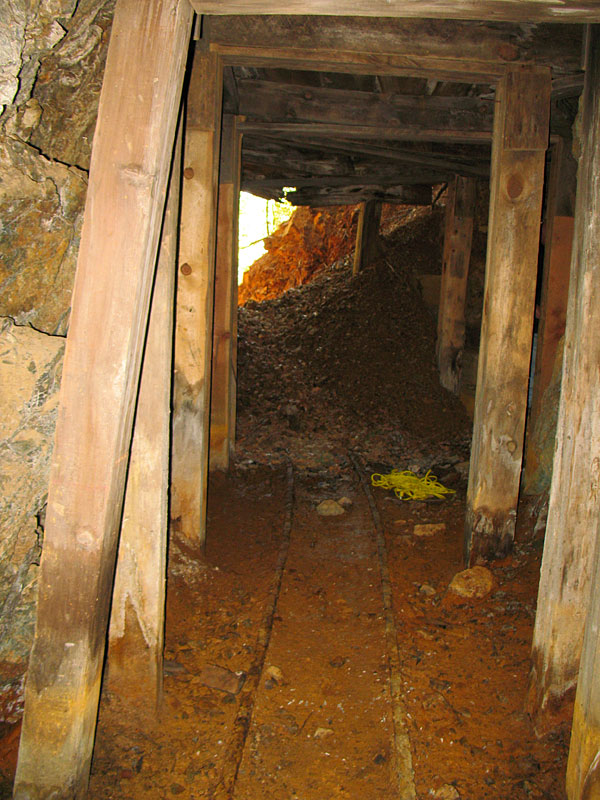
This was a nice exploration but it ended in a collapse. with the narrow rails going right into debris.
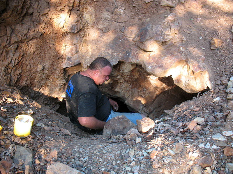
Directly above this was a mine entrance to a second level that turned out to be stunning. This entrance was a tight fit and required crawling laying flat on our backs to get in.
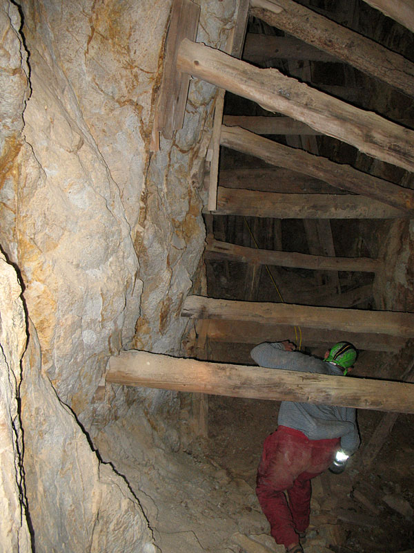
amazing use of tree trunks everywhere
Adopt a road ?!??!
Once you get to this location use a handheld GPS to locate it exactly using the above coords which are accurate to 10ft.
This is a GPS track of our trip up there. Notice the VERY SLOW speed we went. The area with all the red is where the mine is. This also shows the way to get there from highway 89. This also shows our side trip across the mountain from the mine and shows our short excursion to check out the Buzzard Mine close to the Blue Dick Mine
This map was created using GPS Visualizer's do-it-yourself geographic utilities.
Please wait while the map data loads...